
Convey640 is the ideal solution for Landmen, Geologists, Engineers, Analysts, Executives, and Mineral Owners.
See what you can do with Convey640
Industry Leading Data
We collect data directly from public sources, including OKCountyRecords, Oklahoma Corporation Commission, Oklahoma Tax Commission, FracFocus, U.S. Energy Information Administration & More.
A&D: Mineral Deeds, Oil & Gas Leases, Assignments
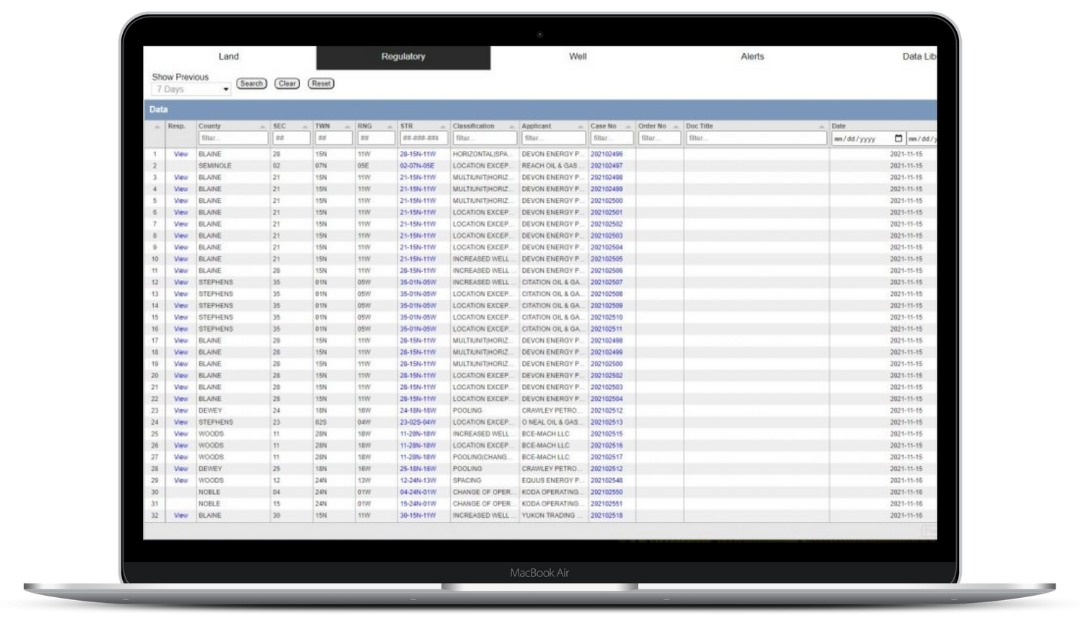
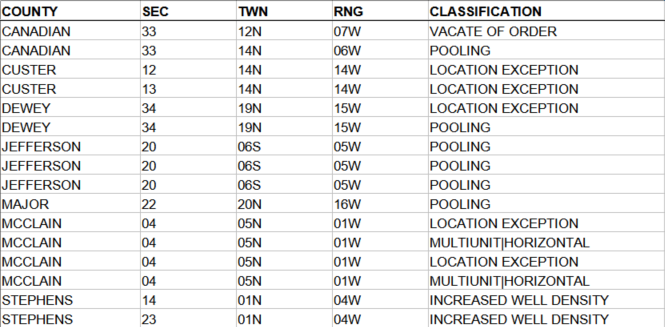
REGULATORY: Spacings, Poolings, Increased Densities, Multiunits, Location Exceptions, & More
DRILLING & PRODUCTION: Permits, Completions, Transfers, Spuds, DUCS, Well Records, & Production

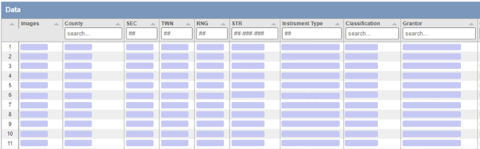
Filter your results
Search datasets by county, section-township-range, classification, grantor(ee), company, well headers, and more.
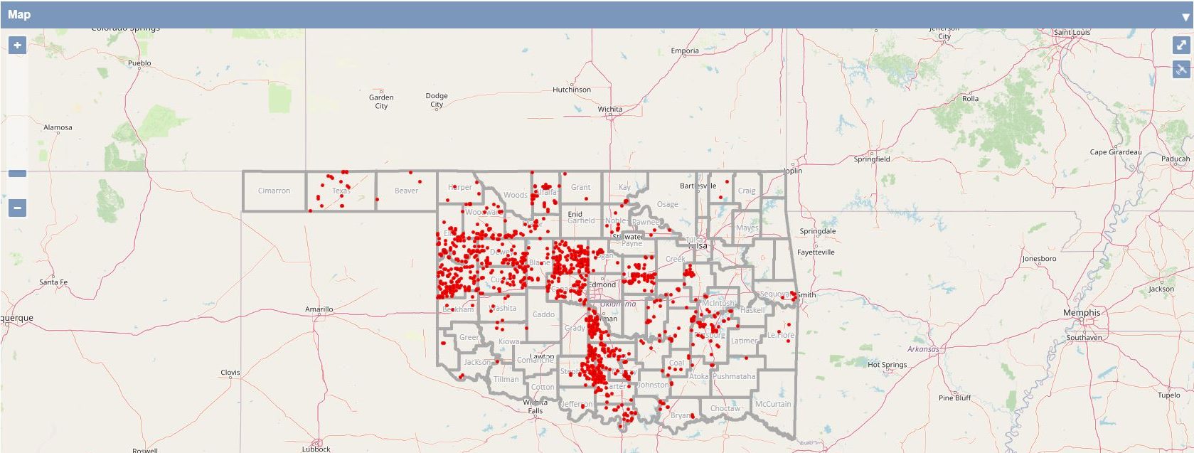
See it on a map
View data on an interactive gis map that allows you to zoom down to the section-township-range layer.
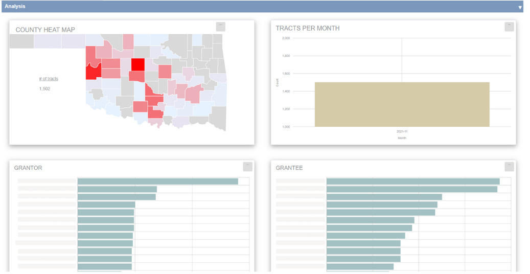
Perform quick analysis
The integrated charts and graphs help you understand complex data within minutes. You can view trends, leaderboards, heat maps, and other analytics
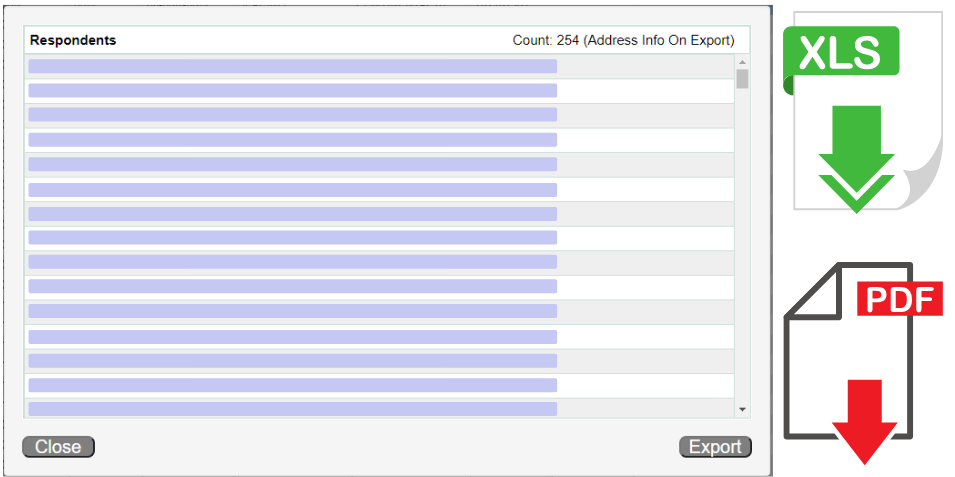
Export data and view files
Export respondent names and addresses to quickly generate mailers. You can also also export all table data to a spreadsheet for further analysis. Easily view original PDF files for additional details.
Custom Alerts
Set up custom alerts to monitor lands, companies, cases, and more. Receive notifications directly in your inbox each morning.
AOI: Instantly know when a company files permits, regulatory filings, and land records near your assets. Import all of your sections with our AOI Uploader and set up alerts in 1 click!
COUNTY: Monitor an entire county for a & d, regulatory, and drilling activity.
TOWNSHIP-RANGE: Or narrow your activity focus to a specific township and range.
API: Follow a well thru its life cycle from permit, spud, completion, to transfer.
OCC CASE NO: Track the progression of a case from the Application Status to the Order Status, and receive notifications whenever a new docket, such as a Notice of Hearing, is filed.
APPLICANT: Stay informed every time a specific applicant files a new Application or Order.
OPERATOR: Like buying under certain operators? Now you can watch their drilling activity and know when they are drilling new wells.
GRANTOR: Keep tabs on an individual or company to see if they are unloading assets.
GRANTEE: Know when a company is acquiring leasehold, buying minerals, or leasing acreage.
RESPONDENT: Do you conduct business under multiple entity names? Easily observe when 1 or more of your entities is named as a respondent in an OCC Application.
Activity Sent To Your Inbox Each Morning
Start your morning off with the Daily County Report . Receive a spreadsheet each morning of Yesterday’s Oklahoma Corporation Commission filings, including Apps , Orders, Permits, Completions , and Transfers.
And each Monday you will also receive our Conveyance Insight Report . Inside this PDF you will find Mineral Deeds, Assignments, and Oil & Gas Leases from the previous 7 days.
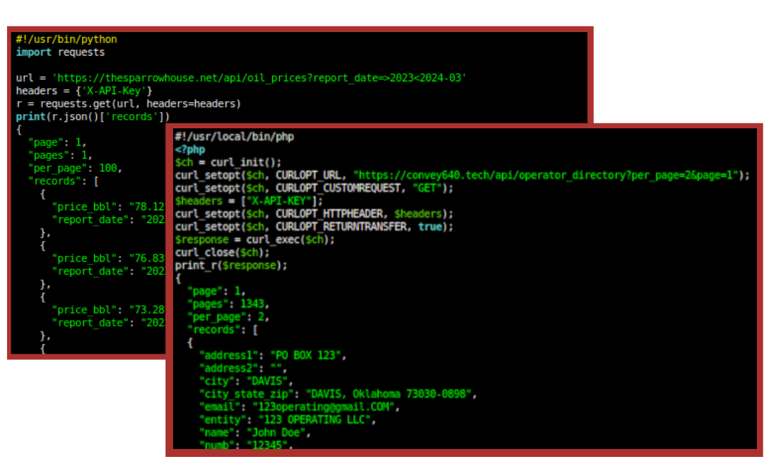
API & Custom Data Feeds
Effortlessly incorporate our API (Application Programming Interface) or Custom Daily Data Feeds into your workflow and unveil invaluable insights. Our RESTful API enables seamless integration, allowing you to make calls using any programming language such as PHP and Python. Unlock the full potential of Convey640 data with ease.
Manage Users & Alerts with Ease
COMPANY-WIDE AOI ALERTS: View, edit, or remove alerts set by any user in your organization, all in one place.
CENTRALIZED USER MANAGEMENT: Quickly add users, update contact info, or assign admin roles as your team grows.
FULL ADMIN VISIBILITY: Know exactly who’s monitoring what, and ensure nothing falls through the cracks.