
A&D
A&D
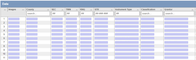
Track deeds, leases, assignments, grantors, grantees, and ownership-related activity with faster access to source-backed records.
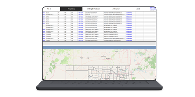
Convey640 brings together regulatory filings, courthouse records, drilling activity, production data, mapping, alerts, and exports in one searchable platform for teams that need answers fast.

Move across A&D, regulatory, drilling, and production workflows without jumping between scattered systems.
Track deeds, leases, assignments, grantors, grantees, and ownership-related activity with faster access to source-backed records.
Review applications, orders, respondents, case numbers, classifications, and related OCC activity in a cleaner workflow.
Analyze well-level production, trends, counties, and supporting context with dashboards, filters, and exports.
Monitor permits, spuds, completions, transfers, and field activity across the areas and operators that matter most.
Convey640 is designed to reduce manual research time and give your team a more complete view of Oklahoma oil and gas activity in one place.
Search by county, section-township-range, classification, instrument type, operator, case number, respondent, applicant, grantor, and grantee, then move directly into maps, alerts, exports, and analysis.

Bring together courthouse, regulatory, and related data into a more usable, searchable system.

Track counties, companies, operators, applicants, respondents, case numbers, and more.

Support research, technical review, and internal workflows with company-based plans and shared access.
Real workflows. Real records. Faster paths from search to map, analysis, export, and notification.
Filter by county, section-township-range, classification, instrument type, grantor, grantee, applicant, respondent, and more to move quickly through large data sets.
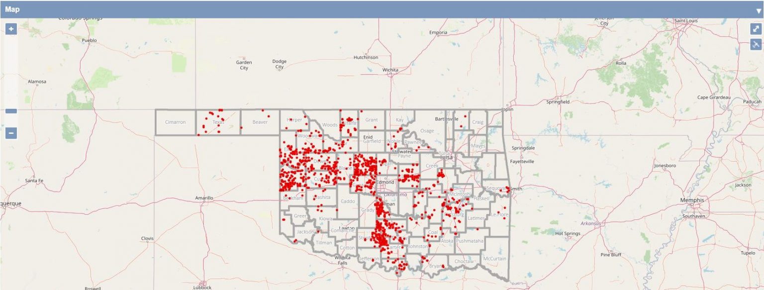
Visualize activity across Oklahoma and move from broad geographic review into the exact counties, sections, and tracts that need attention.
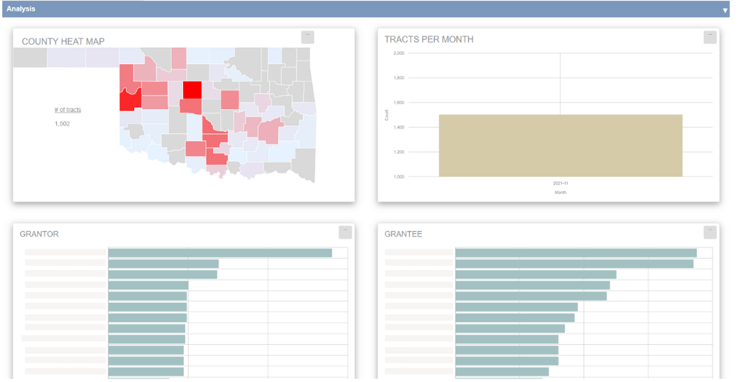
Use dashboards, charts, and summarized views to interpret grantor, grantee, county, tract, and other activity faster.
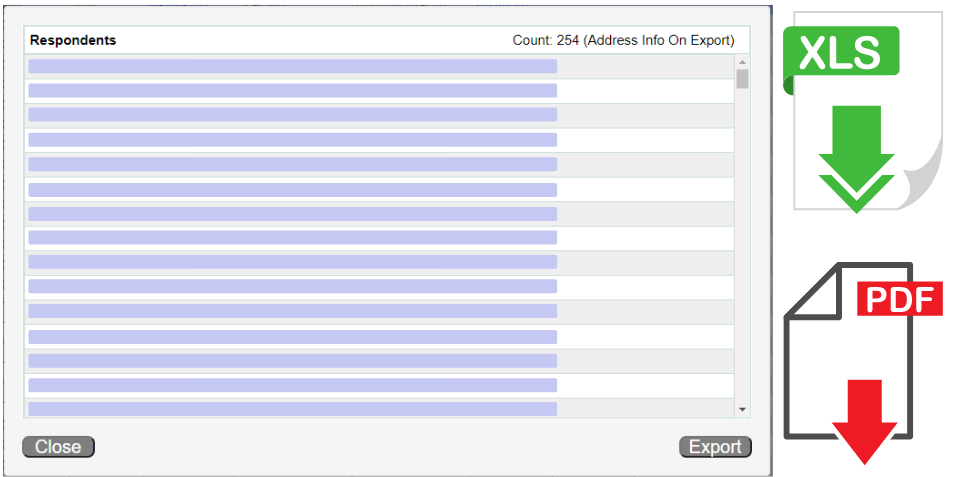
Generate exports for spreadsheet workflows and shareable deliverables, including PDF- and XLS-oriented research output.
Designed to support land, regulatory, mapping, alerting, analysis, and internal team workflows.
Sort, search, and work through large result sets efficiently with filters and linked workflows.
Move between records and geography using county, tract, and map-based review.
Use charts and dashboards to turn search results into digestible analysis.
Keep workflows grounded in underlying records while benefiting from structured presentation.
Monitor the entities, geographies, and case activity most relevant to your team.
Support downstream workflows with exports and API-oriented delivery options.
Use the product overview video for a guided look at how Convey640 supports research, mapping, alerts, and analysis workflows.
All plans are company-based, with no extra charges for additional users.
For teams focused on land, ownership, regulatory review, and core research workflows.
Billed annually
For companies that need broader internal access, deeper analytics, and higher-volume data workflows.
Billed annually
No risk. No credit card required. Includes all Technical Plan submodules and 100 exports.
Schedule a 1-on-1 demo to walk through the platform, your workflow, and the data that matters most to your team.